Big Gee in Action


| Album: journal:20110819 | ||||||||||
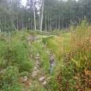
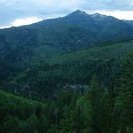
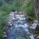
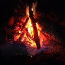
Un-effing-believable. The person responsible for trails around here needs his/her assed kicked. How many thousands and thousands of miles have I hiked without navigation problems? Why is this area so ridiculously bad? Somehow I got off the Dark Canyon Trail and ended up on what was probably an outfitter's use trail to their campsite. Only I didn't know it. The trail went down to a little creek and crossed it but the other side had only what looked like 3 game trails leading away. I explored each a short distance didn't think any were what I wanted. I decided to backtrack to Silver Creek a short distance behind me. I explored around there but didn't find any better alternatives. At the time I thought that where I crossed Silver Creek was indeed the right trail but I doubt it now. I figured that the trail must have just gotten overgrown so I went back to the little creek and started bushwacking. It was horribly exhausing and slow. In a clearing I shot a bearing to Marcellina Mountain and it ran right up the gulch I'd already figured I was in and intersected the trail. I happened to be on a faint trail at the time so I figured that was as good as it gets. Wrong. Further along I shot a line to both Marcellina and Mt Owen. The lines intersected maybe a quarter mile east of the trail but I sort of didn't believe that I had gotten that far off. I still didn't realize that I was probably off trail at Silver Creek. I thought it was more likely I had misidentified either mountain's high point or even the mountains themselves so that was throwing my measurements off. Regardless I knew that if I kept contouring around the slope I'd eventually hit one of three different trails (assuming I'd see them). That's what happened. I figured out that it was Silver Basin Trail from it's direction so I descended and soon was back on Deep Canyon but at the expense of hours and hours of lost time and energy. I'll still get to Marble tomorrow but it won't be the easy day I expected. Camping here on North Anthracite Creek is good at least. The ground is flat and it is a popular spot with a stone fire ring and some wood waiting for me. I decided to have my second campfire of the trip here. It helped cheer me up. I'm at 7,300 ft only. I don't remember when I was last this low. Maybe the start of the trip.
|
||||||||||
| Available Images: | ||||||||||
 |
 |
 |
 |
|||||||
| imgp5484 | imgp5485 | imgp5486 | imgp5487 | |||||||
 |
 |
 |
 |
|||||||
| imgp5488 | imgp5489 | imgp5490 | imgp5491 | |||||||
 |
 |
 |
||||||||
| imgp5492 | imgp5493 | imgp5494 | ||||||||